|
Unit No.
|
Topics to be Covered
|
Lecture Hours
|
Learning Outcome
|
|
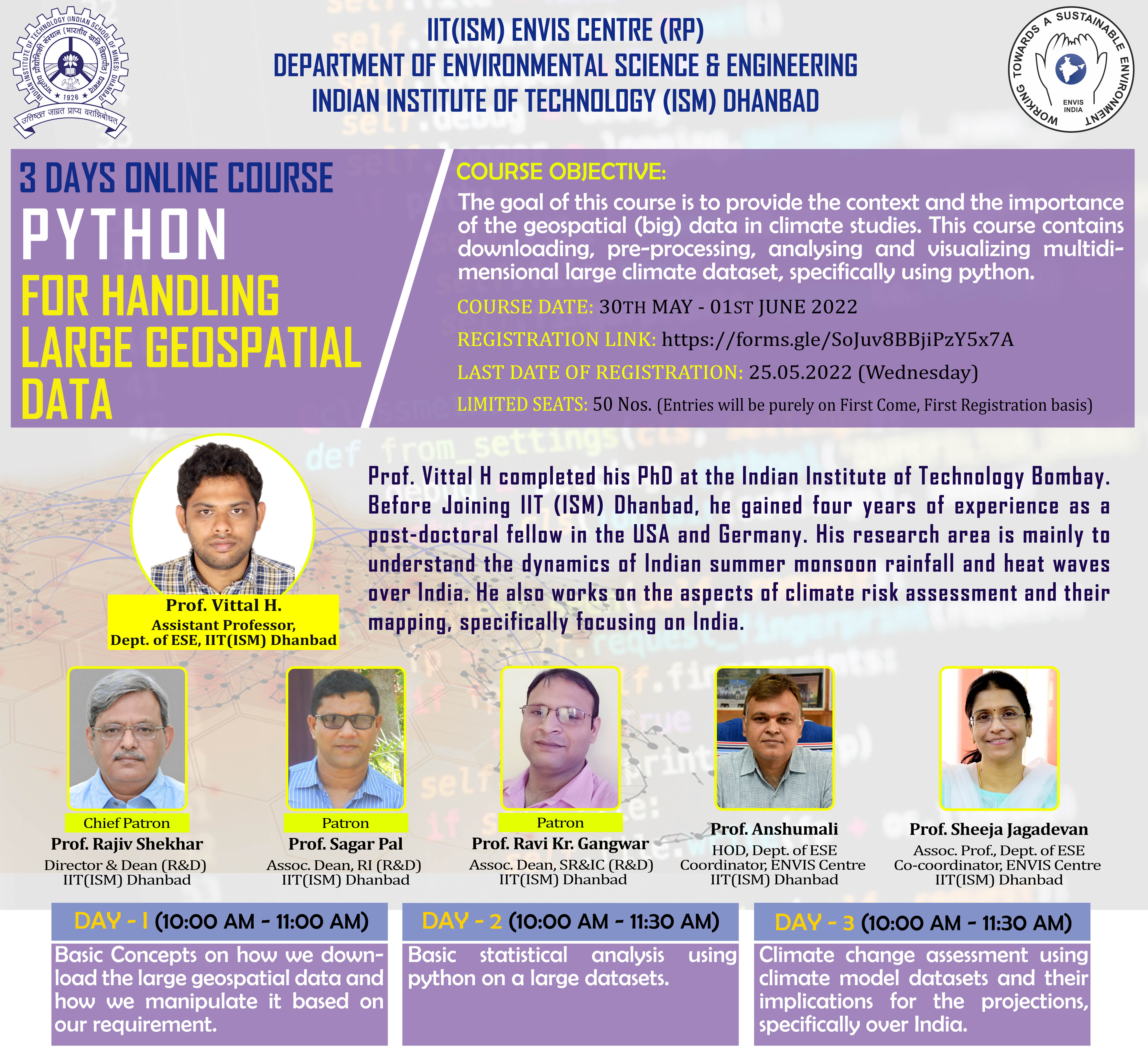
DAY – I (10:00 AM to 11:00 AM) 30.05.2022 (MONDAY)
|
|
1
|
Basic Concepts on how we download the large geospatial data and how we manipulate it based on our requirement
In this section, we will download and analyse some of the large geospatial data. Further, we will extract (average) the data monthly and yearly – based on our requirements and also we will plot these manipulated datasets.
|
1
|
Learn how to download and extract the dataset –
Based on the requirement, using Python
|
|
DAY – II (10:00 AM to 11:30 AM) 31.05.2022 (TUESDAY)
|
|
2
|
Basic statistical analysis using python
In this section, we focus on how we perform basic statistical analysis for large geospatial datasets using python – such as trend analysis, correlation analysis, moving average, and so on.
|
1.5
|
We will learn about performing a basic statistical analysis on a large datasets in python
|
|
DAY – III (10:00 AM to 11:30 AM) 01.06.2022 (WEDNESDAY)
|
|
3
|
Climate change assessment using climate model datasets
In this section, we will assess climate change using a recently released state-of-the-art climate model inter comparison Projects – Phase 6 (CMIP6), specifically over India. Here, we use precipitation and temperature as an example.
|
1.5
|
We will learn about climate models and their implications for the projections, specifically over India.
|
 CLICK HERE TO DOWNLOAD THE COURSE FLYER